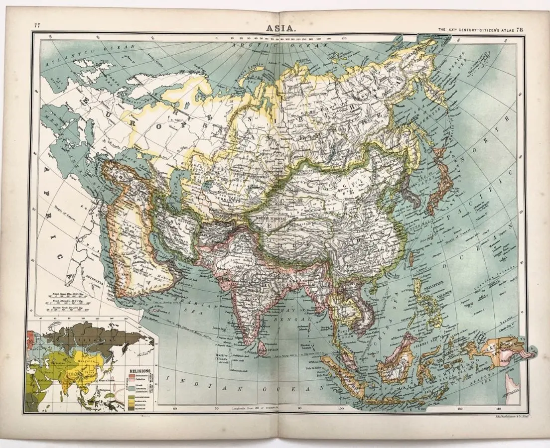
Asia Continental Chromolithograph Map 1898
Circa 1898SGD 250
The map captures Asia at the height of European imperial power and global commercial expansion. British India is prominently delineated in pink, while the Russian Empire extends across Siberia and Central Asia; French, Dutch, and other colonial possessions appear throughout Southeast Asia and the East Indies. The inset “Religions” map reflects the period’s Western interest in classifying peoples and territories by faith, presenting a late-nineteenth-century European understanding of Asia’s immense religious and cultural geography. As such, the sheet is a compelling historical document of the “Great Game,” colonial administration, expanding rail and maritime networks, and the geopolitical worldview that shaped the final years of the nineteenth century.
Asia
Antique Map
H: 36 cm W: 46 cm
H: 14" W: 18"